

BMKG: Eruption of Mount Anak Krakatau Disrupts Flights
Translator
Editor
26 December 2018 12:38 WIB
TEMPO.CO, Jakarta - The head of the Meteorology, Geophysics and Climatology Agency (BMKG) Dwikorita Karnawati had stated that the eruption of Mount Anak Krakatau is dangerous for plane flights.
“Obviously, and we monitor it [the mountain] all the time with the Himawari satellite,” Dwikorita said at a press conference at the BMKG building, Tuesday night, December 25.
“From our monitoring, the direction of distribution of the ashes will be detected due to the direction of the wind,” she continued.
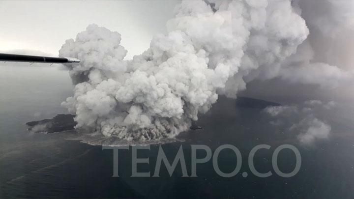
Dwikorita explained that the BMKG had tried to directly check the crater cliff of the Mount Anak Krakatau by air. The team has flown twice to check directly, but until now, it has not been successful. “The clouds are thick,” she said.
On the first day of the flight, it was also known that the aircraft’s glass was exposed to ash particles. “So that we and the TNI (Indonesian military) stated that this could endanger the aircraft engine,” Dwikorita said.
Read also: BNPB: Many Sunda Strait Tsunami Victims Swept into Sea
Today, the weather condition around Mount Anak Krakatau is predicted to have moderate to heavy rainfall in the morning to evening.
“At night until early morning, it is generally cloudy and there is a light rain. The direction of the wind is from southwest to west, but the speed of the surface wind is relatively decreased compared to the previous day, with a maximum speed reaching 20 to 25 kilometers per hour,” Dwikorita said.
The National Disaster Management Agency (BNPB) noted that until Tuesday at 1 pm, the death toll from the tsunami in the Sunda Strait reached 492 people. Until the third day, 1,485 people were injured, 154 were missing and 16,082 evacuated.
The tsunami allegedly caused by the landslide of sediment material around Mount Anak Krakatau, it affected five regencies, namely Pandeglang and Serang in Banten Province, and South Lampung Regency, Pesawaran and Tanggamus, Lampung Province.
ANTARA


